-Political geography of Raz and Jargolan County:
Raz and Jargolan County, centered on the city of Raz, occupies the northern and northwestern parts of North Khorasan Province and is bordered by Turkmenistan to the north, Shirvan County to the east, Mane and Samalghan County and Golestan Province to the west, and Bojnourd, Mane and Samalghan County to the south. This county has an area of about 3,138 square kilometers and has one city and three districts. The population of Raz and Jargolan County in 2013 was estimated to be 65,000 people.
– Natural geography of Raz and Jargolan County:
A large part of Raz and Jargolan County is mountainous and has shallow valleys. In general, this area has cold and wet winters and hot and dry summers. The watersheds of the region include the Sumbar River, Jargolan River, and Gholaman River in the north of the region, and the Tangeh-e-Torkaman River watershed in the south of the county, which is climatically influenced by the air mass of the Caspian Sea. The Kopeh-Dagh mountain range and the Sumbar Valley in the north serve as a natural border between Turkmenistan and the county, and are limited to the heights of Bojnourd County and Maneh and Samalqan County in the south.
According to preliminary archaeological research, Razo-Jargolan County has been inhabited since prehistoric times (3rd millennium BC) and has been of particular importance due to its strategic location and abundant natural resources. The presence of prehistoric settlement sites in the Gholaman River basin and historical mounds in the Raz Valley and Jargolan Valley are evidence of continuous human habitation in this county during various periods of human history.
– Historical background of Raz and Jargalan
According to preliminary archaeological research, Razo-Jergolan County has been inhabited since prehistoric times (3rd millennium BC) and has been of particular importance due to its strategic location and abundant natural resources. The presence of prehistoric settlement sites in the Gholaman River basin and historical mounds in the Raz Valley and the Jergolan Valley is evidence of continuous human habitation in this county during various periods of human history.
Tomb of Prince Nabi Ghulaman
The building of Prince Nabi Ghulaman is located 200 meters south of Ghulaman and overlooks it. This building was rebuilt in 1318 by order of Captain Amir Abbas Dibaj, the then governor of the region, and by Master Sheikh Ali Norouzi and under the supervision of Mohammad Rahmani. No trace of the structures before the restoration and reconstruction of the building remains today, and the entire current structure of the Imamzadeh building dates back to the time of the first Pahlavi dynasty. This building is hexagonal in shape with a porch and the main materials are brick, plaster, mud mortar and wood. The porch of the building faces north. One entrance to the building is from the porch and north, and the other entrance to the building is from the west. The building has two inscriptions, one above the entrance door and the other above the porch door, which refer to the year of reconstruction and the builders. Considering the scattering of a large number of pieces of glazed tiles and bricks, it seems that these materials were also among the decorations of the building, which have disappeared today. There is no evidence left of the decoration of the interior of the building due to the restoration and covering with a layer of plaster. This shrine is highly respected among the people of the region, and the present-day Ghulam cemetery has also been formed around it.
Raz Historical Collection
The oldest evidence of the settlement sequence of the city of Raz remains today in its northern areas in the historical hill of “Bayar Qala” and the hill of “Mujavar Sefid”. According to archaeological evidence, Bayar Qala was a small part of a large rural settlement from the Islamic Middle Ages (5th century AH to the present). Mujavar Sefid hill was also part of the past settlement of Raz, which had military and governmental use. Mujavar Sefid hill is located in the eastern part of Bayar Qala and in some parts of it, evidence of military walls and fortifications still remains. The third work of this complex is the historical cemetery of Raz, which is located in the southern part of the present-day context of the city of Raz, and according to the petroglyphs on its graves, the use of the cemetery dates back to the Safavid era. In the southwestern part of this cemetery are the remains of the tomb known as Fakhr Razi, which is highly respected among the people of the region. Due to the complete destruction of the tombstone and the loss of archaeological evidence, there is no precise information about the original identity of the person buried there. The fourth work in this collection is the ancient “Cypress” tree, located in the central part of the city. This tree, which is approximately 800 years old, has been registered as a natural monument in the National Monuments Register.

Almadoshan Historical Citadel
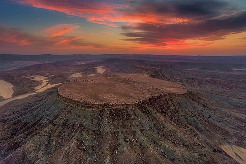
Almadoshan Citadel is located on the highest part of a cylindrical and isolated mountain. The surface of this mountain is relatively flat, the east-west length of this castle is more than 100 meters and its north-south width is about 500 meters. There are rubble and piles of rubble in all parts of the surface of this mountain, each of which was the ruins of a building. On the southernmost surface of this mountain and near the edge of its precipice, there is a large rectangular building that seems to have been the most important building of this castle. The name of this monument is taken from the village of Almadoshan, which is the nearest village to it. This name means “the place where apples fall” in Turkish. Regarding the age and history of the monument, it can be said that Almadoshan Citadel is a military fortress that was used from the Parthian era to the Islamic Middle Ages, i.e. the 6th and 7th centuries AH. Due to its location and natural features, Almadoshan Citadel has been important from a military point of view for a period of 1500 years, i.e. from the Parthian era to the Islamic Middle Ages.

Upper Arg Hill
Arg Bala Castle is located on a flat part of a mountain with a northwest-southeast direction. The east-west length of this area is 300 meters and its north-south width is about 200 meters. The fortifications and structures of the castle are entirely in its southern part. In other parts of the castle, the mountain wall is vertical and there is no climbing to it. The length of the rampart, which covers all the southern parts of the area and prevents easy access to the inside of the castle, is about 150 meters in the northeast-southwest direction. The number of towers that existed on the path of this rampart was 5 and semicircular. Regarding the history of this monument, considering the destroyed structures and also considering the large number of broken pottery pieces on the surface of the site, it can be said that this monument is a large military castle from the Parthian era of the region. Arg Bala Castle is one of the most important military castles in the northern Khorasan region, considering its size and location.

Rastaqan Historical Site
This site is a large rural settlement site from the Middle Islamic period, i.e. the 6th to 8th centuries AH, near the village of Rastaqan. The north-south length of this site is about 250 meters, and its extent starts from the inner parts of the valley on the riverbank and continues to the upper reaches of the valley, and the east-west width of the site is about 150 meters. The location of the remains of a military citadel 100 meters east of this site and a large cemetery 300 meters south of this site, all three of which have overlapping dates, are signs and evidence of the existence of a complete settlement complex from the Middle Islamic period in this place. The existence of this site, along with the other mentioned sites, doubles the importance of studying and investigating the archaeology of the region.

Tomb of the Great Sayyid
The Great Seyyed Mausoleum is one of the tombs in the region with local architectural features, located 500 meters east of the border village of Parse-su. According to the architectural features, the building dates back to the Timurid period and was also renovated during the Safavid and Qajar periods. The structure and plan of the tomb is a domed quadrangular building. The tomb is built on a rectangular platform made of stone and mud mortar. The dimensions of this platform are 10 x 18 meters, which is now largely covered with cement mortar. Two entrances, one in the west with seven steps and one in the south with three steps, have been created to access the platform. The main plan of the building includes a large porch on the east side and a square dome house, which in addition to the porch entrance also has entrances from three other main directions. It seems that the building previously had four domed arches, to which the porch was later added.